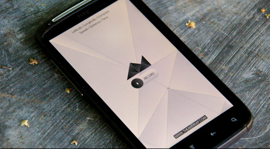
AntiMap Log

AntiMap Log is a smart phone utility application for ‘recording’ your own data. Whether your out snowboarding, skiing, mountain biking, driving, running, or whatever your into, AntiMap Log is a DIY solution for gathering real-time stats with your phone. The indexed data can then be used in conjunction with any of the free AntiMap post analysis applications (or your own creations) to visualize your every move.
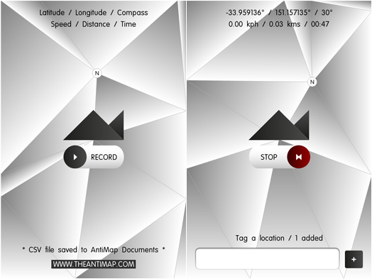
The application uses the GPS and Compass sensors on your phone to extract and store the following data: latitude, longitude, compass direction, speed (kph), distance (kms), time (milliseconds), and finally an input field for optional points of interest.
The application is free and Open Source, with Processing (Android) and Openframeworks (iPhone) source code provided in hope that users can learn from and find interesting ways to visualise their data.
Data
Recorded data is saved to a CSV file at 30 FPS with filenames matching the date & time they were created. Eg: ‘150811_1230_08.csv’, was created on the 15th August 2011, at 12:30pm and 8 seconds. For Android users, files can be retrieved from the ‘AntiMap’ folder on the SD card. For iPhone users, files can be retrieved from your device in iTunes/Devices/Apps/AntiMap Log Documents (just under the ‘File Sharing’ heading).
Approximately 10 minutes of record time equates to 1mb of data on your device. To keep things tidy, I recommend deleting the files from your device once you’ve copied them to your computer.
Sample row of data from a CSV file: “-39.245163, 175.561, 320, 2.7769525, 218904, Ruapehu trail”. These 6 values shape the foundation for all current and future AntiMap desktop/online applications.
How to use?
Once you have the application installed on your device, there are a few things you need to know if you want accurate results generated for your data.
- Only use outdoors
- Data will not save unless GPS is detected, so wait until the “* Waiting for GPS signal… *” has disappeared before activating the “RECORD” button.
- Give your phone a good wave around in the air to ensure the compass configures itself properly.
- Depending on the activity your performing, the position of the phone once recording is crucial. If you require accurate orientation/axis values for snowboarding (spins/rotation) I recommend placing the phone upright against your lead hip/waist inside your pants. Just placing it in any of your pockets works fine for everything else except rotation as it moves around when loose. For skiing, maybe down the front of your pants.
- Be careful you don’t accidentally turn off the display while positioning the phone as the application does not ‘run in the background’.
- The application does not capture video, the application only logs the data. This is to keep the riding (or whatever) experience as unaffected as possible.
Version & download links: AntiMap Log 1.0
AntiMap Log is at version 1.0. Download the iPhone and Android applications below. If you want to see how these apps were built in Openframeworks (iPhone) & Processing (Android), source code can be downloaded from GitHub here.
Application and source code are released free under the MIT license (http://www.opensource.org/licenses/mit-license.php).
We’ve added a section to the GitHub page for upcoming AntiMap Log features. If you’d like to help with any of these issues, see here: https://github.com/trentbrooks/AntiMap/issues


Could you be a little more specific about retrieving data from the iPhone with iTunes?
I have a mac, and iTunes 10.5.2, I don’t understand where to find this - ” iTunes/Apps/AntiMap Log Documents (just under the ‘File Sharing’ heading). ”
Thanks.
got it - it might be easier if you said -
1 - Open iTunes,
2 - Browse to your device,
3 - Inside of the Apps tab scroll down to the file sharing area and look at AntiMap Log Documents
stefan - Yeah that’s it, I’ll update the instructions soon. Here’s a screenshot of where the data is located in iTunes: http://theantimap.com/wp-content/resources/screenshots/iphonedata.png
It might be a silly question, but how I should read the compass data? Could you give the key or link where I can find the answer? I am not great with iPhone API so I am not sure how to decode it.
Overall fantastic app! Digging it…
Geek On Acid - the data for the compass is located in the 3rd column of the CSV files you create when recording. You can check the ‘AntiMap Simple’ source code for an example on how to read in the data: https://github.com/trentbrooks/AntiMap/tree/master/AntiMapSimple
@admin: Thanks. I know which column it was, I just wasn’t sure what the number stands for. Looking at the example code you linked, it seems that the compass only gives me a direction (between 0-360), right?
[...] is an Open Source project designed to make use of the data that smartphones can register. The AntiMap Log app is available for iOS and Android devices. This tool records GPS and accelerometer data for [...]
Nice App. One suggestion for the next update - a preference setting to allow lower framerates and/or select which positional data are recorded (eg acceleration and compass). I just want an app that can export csv showing where I’ve traveled in a day, so don’t exactly need 30fps
Great App. Now I can see what’s inside the phone !

I’ve made a small page to display an AntiMap track on a map using OpenLayers :
http://geopole.free.fr/antimap/antimap.html
As Pete says an option to filter the number of points would be great (threshold on time, distance and/or compass to avoid registering points when nothing happens).
The position occuracy or altitude could also be a good information to log.
And what about the posibility to link to a photo ?
I’m very excited about this app but I have a few minor suggestions in no particular order:
* I agree with others that an option for slower sample rate would be nice (maybe with averaging?).
* Could we also record accelerometer data?
* Filenames will sort better if they are in year-month-day format rather than day-month-year.
* How do I delete log documents from my iPhone?
Thanks to everyone for their suggestions, please keep them coming. I’ve added an issues/features page for things to add to the next version of AntiMap Log - things like a settings menu with adjustable frame/sample rates and additional data like altitude and accelerometer have been added. https://github.com/trentbrooks/AntiMap/issues
@Carl delete the log documents from your device in iTunes/Devices/Apps/AntiMap Log Documents (just under the ‘File Sharing’ heading). Also good suggestion about the filename sorting!
[...] latitud, longitud, dirección, distancia, tiempo y la posibilidad de realizar ingresos a mano. Esta aplicación sirve para obtener los datos crudos permitiendo que el usuario los utilice para lo que desee, puede [...]
Great app! This app was almost perfect for my need to record some data and export to excel to generate graphs. Here are some of my suggestions:
* I agree - lower frame rates, or user set frame rates
* Can you add speed measurements as well? I need to compare speed against the accelerometer readings
* User defined fields to record.